
TEAM
We are your specialists from various fields, while additionally drawing on a pool of knowledge through our close cooperation with the Department of Geoinformatics at the University of Salzburg.
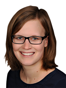
Kerstin Herzinger, MSc
Managing Director
kerstin.herzinger(at)spatial-services.com
A Rockstar GIS analyst by trade, Kerstin Herzinger is responsible for our humanitarian services like risk mapping and emergency management, where she quickly and efficiently provides real-time information when disasters happen. Armed with a degree in geography and GIS, Kerstin has a knack for restoring order from chaos and transforming dull datasets into actionable insights. She particularly enjoys all things remote sensing, digital image processing and data analysis related.
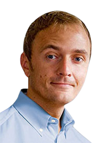
Markus Kerschbaumer, MSc
Managing Director
markus.kerschbaumer(at)spatial-services.com
Markus Kerschbaumer is a man of many talents, including marketing and graphic design (oh, and did we mention GIS?) He holds degrees in Geography and GIS and is responsible for our projects that deal with mobile data analysis, citizen participation, climate change, and more. He is also our organisational mastermind with tabs on all operations here at Spatial Services, so he’s your go-to guy if you’d like some more information on any of our products or services.

Dipl.-Ing. (BA) Steffen Reichel
Software Engineer and GIS Expert
steffen.reichel(at)spatial-services.com
Steffen Reichel lives and breathes code and can turn a bunch of zeros and ones into something really cool with a mere sleight of hand. He has applied this mystical superpower in a range of settings, including developing front-end and back-end environmental sensor control software, as well as web-based decision support and communication services. He has also developed dynamic web portals using standards-based cataloguing services and dynamic web mapping applications. In other words, he’s in charge of programming and keeping the technical side of things running smoothly.

Kristýna Měchurová, MSc
GIS Analyst and Project Manager
kristyna.mechurova(at)spatial-services.com
Kristýna Měchurová studied at the famous Charles University in Prague. During her studies, she worked in a GIS department at the company which is responsible for gas transmission in the Czech republic. Her master thesis was focused on the generalization of 3D spatial data models. Czech out her current work at Spatial Services regarding human sensors and strategy for skills development and capacity building in the EO/GI field.

Ahmad Alobaidi, BSc
GIS Analyst
ahmad.alobaidi(at)spatial-services.com
Ahmad Alobaidi, our international earth observation manager is responsible for our humanitarian services. He is fluent in Arabic, English with some Turkish and even German is coming ASAP! Remote sensing and data handling is his daily business which he masters in his calm and precise way. Next to his full time table he even manages to finish his applied geoinformatics study. Amazing!
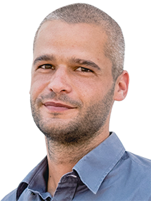
Jonas Schultze-Naumburg, BSc
GIS Analyst
jonas.schultze-naumburg(at)spatial-services.com
Jonas Schultze-Naumburg is specializee in satellite data, regardless of whether it is optical, hyperspectral or radar, he knows his stuff. Remote sensing and data processing for humanitarian purposes are his area of responsibility, which, in addition to his upcoming master’s degree, completely occupies him. His social streak, which he had already used for animals before, was expanded to include the “human” species, so to speak.
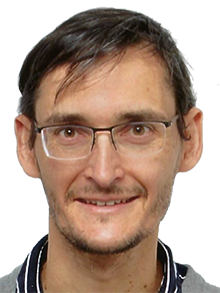
Dr. Florian Albrecht
Project Manager and GIS Analyst
florian.albrecht(at)spatial-services.com
Florian Albrecht studied geography and applied geoinformatics at the University of Salzburg. He has a deep understanding about GIS methods and remote sensing and develops new geoinformation from Earth observation data for users in the application fields of natural hazard management, urban planning, and aviation. In his projects, he works closely together with people from the practice to develop requirements to geoinformation and discuss the usefulness and quality of the derived digital maps.
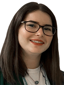
Stamatina Tounta, BSc
GIS Analyst
stamatina.tounta(at)spatial-services.com
Stamatina Tounta holds a bachelor’s degree (with distinction) in Geography from the Harokopio University of Athens, Greece. During her studies, she became particularly interested in Earth Observation and GIS applications, which led to her internship at the National Observatory of Athens, where she worked on an environmental study using time series of Copernicus satellite data. Her bachelor’s thesis focused on water quality monitoring in coastal environments using satellite data. Her area of responsibility is remote sensing applications for humanitarian actions.

Matthias Laher, UNIGIS Professional graduate
GIS Analyst
matthias.laher(at)spatial-services.com
Matthias Laher is not only an incorrigible optimist but also an extraordinary bundle of energy. As a graduate of the UNIGIS Professional academic programme at the University of Salzburg, he is now able to put this drive into practice in his work at Spatial Services in a wide range of areas – especially in the technical support and implementation of projects. He tackles every new challenge with his typical curiosity and enthusiasm.

